This site is intended to provide you with information on Land Surveying in the Los Angeles, CA and Los Angeles County area of California. This website is a marketing site for USA Surveying & Engineering, LLC. If you’re looking for a Los Angeles Land Surveyor, you’ve come to the right place. If you’d rather talk to someone about your land surveying needs, please call our local number at (213) 277-9277 today. For more information, please continue to read.
Land Surveyors are professionals who make precise measurements to determine the size and boundaries of a piece of real estate. While this is a simplistic definition, boundary surveying is one of the most common types of surveying related to home and land owners. If you fall into the following categories, please click on the appropriate link for more information on that subject:
Los Angeles Land Surveying services:
I need to know where my property corners or property lines are. (Boundary Survey)
I have a loan closing or re-finance coming up on my home in a subdivision. (Lot Survey)
I need a map of my property with contour lines to show elevation differences for my architect or engineer. (Topo Survey)
I’ve just been told I’m in a flood zone or I’ve been told I need an elevation certificate in order to obtain flood insurance or prove I don’t need it. (Flood Survey)
I’m purchasing a lot/house in a recorded subdivision. (Lot Survey – See Boundary Survey if you’re not in a subdivision.)
I’m purchasing a larger tract of land, acreage, that hasn’t been subdivided in the past. (Boundary Survey)
Contact Los Angeles Land Surveying services TODAY at (213) 277-9277.
Office-to-housing conversions are happening in cities all over the country. Empty office buildings are getting a second life as apartments and condos, and that shift makes a lot of sense on paper. The buildings are already there. The land is already developed. But converting an office building into housing isn’t just an interior renovation job. The whole site needs a fresh look, and that’s where an ALTA survey becomes a key part of the process before any real planning begins.
Why Residential Conversions Require a Different Look at the Site Than Traditional Office Use
Office buildings were designed around a specific set of needs. Big parking lots for employees. Wide driveways for delivery trucks. Service areas tucked around the back. The site layout made sense for people showing up at 8am and leaving at 5pm, five days a week.
Housing doesn’t work that way. Residents are there all day, every day. They need different things from a site, outdoor space to relax, safer walking paths, places for kids to play, better lighting at night. The parking math changes too. An office building designed for 200 workers might need far fewer spaces when it becomes 80 apartments. Before any of that gets figured out, someone needs to know exactly what the site looks like right now. An ALTA survey records the existing conditions across the full property, giving the project team a real starting point instead of working off old office plans that no longer reflect what’s there.
How Shared Access and Parking Areas Can Affect Housing Conversion Plans
Office complexes rarely sit in isolation. Many of them share driveways, parking lots, and entry points with neighboring properties. Those shared arrangements made sense when everyone involved was running a business on a weekday schedule. They get more complicated when one of those properties becomes a residential building with people coming and going at all hours.
An ALTA survey documents those shared access relationships. It shows where the driveways sit, how the parking areas connect to neighboring properties, and what agreements or physical conditions already exist on the ground. That information matters a lot when a development team starts figuring out how to redesign the site for housing. Shared access that worked fine for office use might need to be renegotiated or physically changed to work for residents. Knowing exactly what’s there before design starts saves a lot of back-and-forth later.
Why Outdoor Amenities and Open Space Matter More in Residential Projects
When a building is full of office workers, outdoor space is mostly decoration. A few benches, some landscaping, maybe a covered walkway. Nobody is spending their afternoon outside. Housing is completely different. Residents want usable outdoor areas, somewhere to sit, walk, let a dog out, or let kids play without going off the property.
That shift in priorities means the project team needs to know what outdoor features already exist on the site and where they sit. An ALTA survey identifies courtyards, walkways, paved areas, landscaped zones, and any other outdoor improvements already on the property. Some of those features might be reused as-is. Others might need to be moved or redesigned to fit a residential layout. Either way, knowing what’s already there gives architects and planners something real to work with instead of starting completely from scratch.
How an ALTA Survey Helps Teams Evaluate Existing Site Improvements Before Renovation Begins
Office buildings come with a lot of site features that have nothing to do with housing. Loading docks for deliveries. Service drives around the back. Detached storage buildings. Generator pads. Utility connections sized for commercial use. Those features don’t disappear just because the building is changing its purpose.
Which existing site improvements can be kept and reused in the new residential layout
Which features were built specifically for office operations and need to be removed
Where utility connections sit and how they relate to the planned residential build-out
What detached structures exist on the property and how they affect usable outdoor space
Having that full inventory early in the process means the team isn’t discovering leftover office infrastructure halfway through a renovation.
Why Housing Conversions Depend on Understanding the Property Beyond the Building Itself
It’s easy to focus on the building when you’re thinking about a conversion project. The floors, the ceiling heights, the mechanical systems, the windows. Those things matter. But the building sits on a piece of land, and that land has its own conditions that affect everything the project team is trying to do.
Access points determine how residents get in and out safely. The shape and layout of the surrounding site affects where outdoor amenities can go. Old utility lines running under the parking lot affect where new connections can be made. Boundary lines determine what the owner actually controls versus what belongs to a neighbor. An ALTA survey pulls all of that together into one clear picture of the full property. Architects, engineers, and developers use that picture to make decisions that go beyond the building walls. For a conversion project that’s trying to turn a commercial site into a place where people actually want to live, that full picture isn’t optional. It’s the foundation everything else gets built on.
Frequently Asked Questions
Why are office-to-housing projects different from standard office properties?
Housing puts different demands on a site. Residents need outdoor space, safe walking paths, and access that works around the clock, not just during business hours.
What does an ALTA survey show during a conversion project?
It documents existing improvements, access areas, shared arrangements, and physical site features that the project team needs to understand before redesign begins.
Can an ALTA survey help evaluate parking and shared access areas?
Yes. It records how parking lots, driveways, and entry points are currently set up and how they connect to neighboring properties.
Who typically requests an ALTA survey for office conversion projects?
Developers, buyers, lenders, architects, engineers, and title companies all rely on ALTA surveys when planning a redevelopment project.
Does an ALTA survey focus only on the building?
No. It covers the full property and records the improvements and features that exist across the entire site, not just the structure itself.
FEMA’s Flood Insurance Rate Maps (FIRMs) or just Flood Maps are provided after a flood risk assessment has been completed or updated for a community. This study is known as a Flood Insurance Study. The FIRM gives you the Base Flood Elevations (BFEs) and insurance risk zones in addition to floodplain boundaries. The FIRM may also show a delineation of the regulatory floodway.
Once the “insurance risk zone” (commonly referred to as the flood zone) is determined, actuarial rates, based on these risk zones, are then applied for newly constructed, substantially approved, and substantially damaged buildings. FEMA uses these rates to determine the insurance rate you will pay for flood insurance
FEMA’s Digital Flood Maps
FEMA discontinued the production and distribution of paper flood maps in 2009 as part of its Digital Vision Initiative. This affected all the Flood Maps, boundary information, and study reports. However, clients can still view the products for free through their website or buy them in digital format.
To view these flood maps online, go to FEMA’s Map Service Center and key in your address (hi-lited area shown here) search for your home. This will prompt you to then select the map that covers your area. The Flood Maps are somewhat cumbersome to use online. It is best to go through the tutorial on the bottom right of the address search page for an easier and more effective use of the GIS map.

 Land Surveyors are professionals who make precise measurements to determine the size and boundaries of a piece of real estate. While this is a simplistic definition, boundary surveying is one of the most common types of surveying related to home and land owners. If you fall into the following categories, please click on the appropriate link for more information on that subject: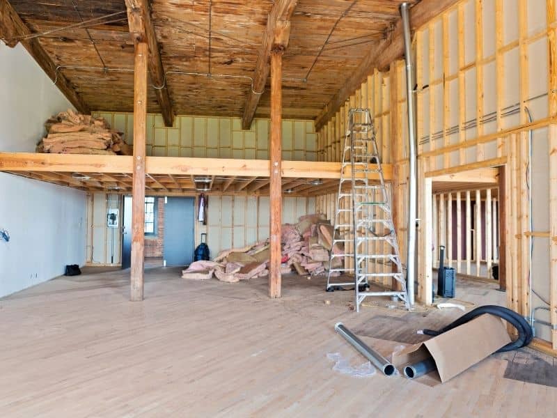
 FEMA’s